Sponsored By:
At Bentley Systems’ annual Be Inspired Awards ceremony, held on October 12 during The Year in Infrastructure Conference in Singapore, nominees were recognized for their BIM advancements in infrastructure. Ten independent jury panels of industry experts selected the 51 finalists from more than 400 nominations in more than 50 countries.
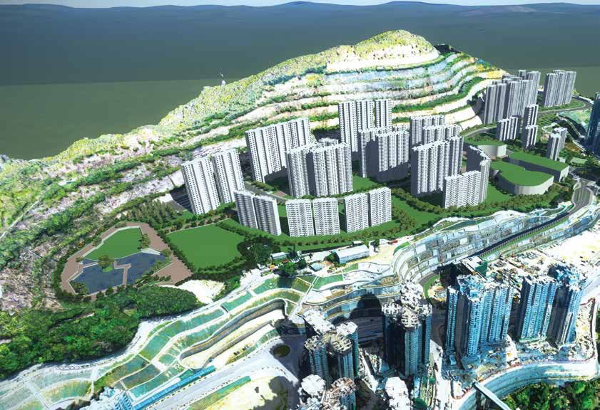
In the BIM Advancements in Reality Modeling category, CEDD-AECOM-The Earth Solutions won for its Development of the Anderson Road Quarry Site project in Hong Kong.
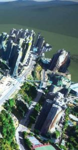
The Anderson Road Quarry site will provide about 40 hectares of land for residential and commercial development to accommodate a planned population of 25,000 people. The estimated USD 1 billion project involves civil infrastructure, such as site formation, road networks, drainage system including storm water detention tank and artificial flood lake, sewerage system, underground utilities, and green space to serve the community. The team used reality modeling to monitor the site progress using photographs and Bentley’s ContextCapture to create a reality mesh, which eliminated the need to have on-site staff perform the survey, avoiding potential hazards and improving safety. AECOM was engaged by HKSARG/CEDD NT East Development Office to design and administer the civil infrastructure works for the first Hong Kong project to use Bentley applications throughout the construction process.
The project team used Bentley applications for managing and sharing data, design modeling and site formation, applying BIM methodologies, monitoring construction progress, and creating visual animations of the completed development to show the public the project. The process reduced on site injury risks, improved stakeholder collaboration, minimized time and resources required for planning and construction progress, and streamlined workflows, minimizing costly rework.
Watch the presentation of the Development of Anderson Road Quarry Site project at www.Bentley.com/YII2017.
In the same category, the two finalists were Pennsylvania State University for Virtual Penn State Campus project and the Sanborn Map Company, Inc., for the Sanborn3D HD Maps for Autonomous Driving project.
Watch the finalists’ presentations for the Virtual Penn State Campus and the Sanborn3D HD Maps for Autonomous Driving projects at www.Bentley.com/YII2017.

With Bentley’s ContextCapture reality modeling software, project teams can cost effectively produce 3D models of the most challenging existing conditions of any scale for use on every infrastructure project, using ordinary photographs. Users can add point clouds for additional accuracy resulting in fine details, sharp edges, and geometric accuracy. Highly detailed 3D reality meshes can be quickly created and used to provide precise real-world context for design, construction, and operations decisions for use throughout the lifecycle of projects.
For additional information about ContextCapture or to try a demo, visit www.bentley.com/
contextcapture or contact the Bentley sales team.

Parul Dubey
Video: New Roundabout Under Construction at McIver and Old Florence Roads in Darlington County

Bridge Replacement at Amsterdam Centraal Station

June Issue 2026
.jpg?width=225)