
A Watershed Moment in Public Alerting
A real-time web map goes a long way to prevent sickness when force majeure strikes. Last winter, a torrential storm caused two water pump outages in Atlanta, Georgia, risking contamination and necessitating a boil water advisory be issued to affected residents. To widen its outreach, the Atlanta Department of Watershed Management (DWM) used social media and the local news to promote a mapping Web site that showed the areas affected by the outages.
Smart Notification
If it’s not live, an advisory’s “advice” is hardly worth heeding since conditions might have changed between communications. During a water infrastructure failure, for example, cities typically inform residents with robocalls recommending the boiling of drinking water within the areas affected. In such incidents, developments change by the hour and tens of thousands of residents need to be apprised of new information as it comes in.
Atlanta’s water rates have increased over the past decade to help pay for the $4 billion Clean Water Atlanta (CWA) initiative. Understandably, the increased bills have been met with sticker shock from residents already paying the 2nd highest water rates in the nation (next to Seattle, Washington). In addition to fixing its physical infrastructure to maintain water purity, Atlanta also improved its IT notification system with a real-time map in cases of infrastructure failure.
Always On Alert
It was 9 p.m. on a Friday night when DWM GIS Manager Dax Flinn received news that heavy rains reduced the water pressure in two critical delivery pumps. Crews were being sent to the area to fix the problem, but in the meantime, some residents’ water would be at risk from bacterial contamination. This is where a live map truly fulfills its purpose. Knowing that his GIS staff could assist in notifying the impacted public, Flinn contacted them to pull a list of the affected addresses.
“Mapping the boundaries in ArcGIS, I was able to identify the meters in that area,” said Andy Creek, DWM GIS Coordinator. “I tied that back to the billing system showing the 22,000 addresses that needed to be contacted about the boil water advisory.”
That’s a good start to begin arranging the robocalls. But, as the situation changed every hour, there had to be a way to express the changes that occurred as they occurred. The robocalls couldn’t possibly report every development. With ArcGIS Online, DWM GIS staff could immediately set up a new web map viewer showing the locations affected by the outage.
“The URL displayed on all browsers, so people could bookmark it and access it anywhere and on any device,” said Lakeisha Tate, DWM GIS Coordinator. “We then informed the communications department that the web map was live and could be promoted.”
Social and Local Media
Within minutes of the map going live, the department took to its official Twitter account to tweet the map link. While 3,000 followers doesn’t sound like a lot, with retweets and word of mouth, it would be significantly better than a robocall-only approach. Even more significantly, tweeting alerted local media about the failure and the web map at the same time. Local news outlets could easily embed the ArcGIS Online map within their online stories.
While test results found no contaminants, a potential health and PR crisis was averted. Flinn credits the more holistic approach of real-time web map, social media, and robocalls for the successful advisory.
“A web map is the only really sensible way to alert a public,” says Flinn. “People are already connected to the web through two or three devices, so it’s better to try to get their attention through any medium that we can. Esri, Twitter, and the local news made it possible to reach many more people much more quickly.”
Multi-advisory Tool
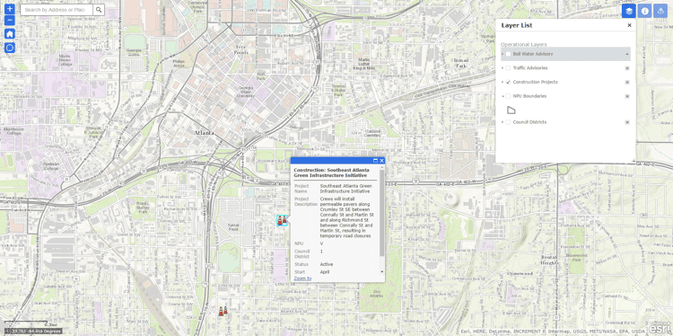
The ArcGIS Online outreach method perfectly complements DWM’s traditional advisory action, filling in the “radio silence” of a comparatively slow telephonic outreach. Flinn and team now use it for all the department’s public advisory purposes, such as issuing traffic obstruction and construction project information.
About David Totman
David Totman began his career with Esri as industry manager for the public works, AEC, and survey markets. He currently manages the Esri corporate membership for the American Water Works Association and American Public Works Association and is a voting board member of the Open Design Alliance. David Totman has been using GIS for more than 25 years in business process optimization, project analytics, and infrastructure management.
